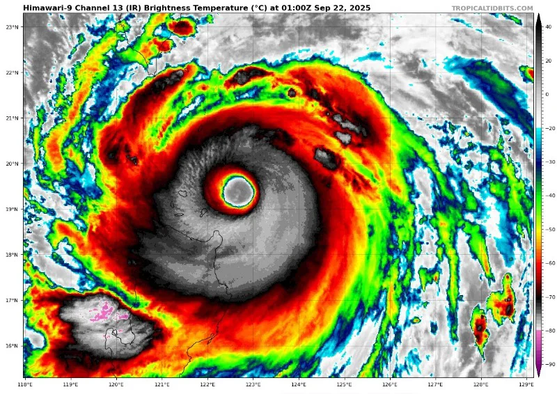
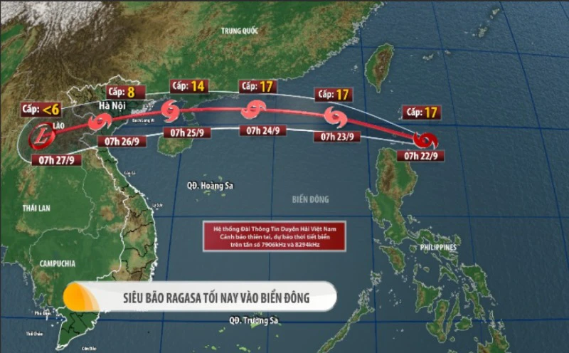
As of 7 AM today (September 22), the typhoon's strength is rated at level 17, with wind speeds reaching 202 to 221 km/h, and the maximum instantaneous wind speed has exceeded level 17. The center of the typhoon is located about 160 km off the eastern coast of Luzon Island in the Philippines.
According to the forecast, tonight (September 22), the typhoon will enter the South China Sea, becoming the 9th typhoon of the year, and is expected to move quickly at about 20 km/h while maintaining a strength of level 17 (maximum instantaneous wind speed above level 17) for the next 24 hours. It has already surpassed the maximum strength of Typhoon Yagi in 2024 over the sea and is expected to be one of the strongest super typhoons ever recorded in the South China Sea.
By the morning of September 25, the typhoon is likely to approach the Northern Gulf (Tonkin Gulf) with a strength of levels 12 to 14 and a maximum instantaneous wind speed of levels 15 to 16, and it is expected to have a direct impact on our inland areas from Quang Ninh to Ha Tinh.
📸 Satellite image of Super Typhoon Lagasa taken at 8 AM on September 22.